Montreux Panoramas
In this post I present to you three panoramas of Montreux and surroundings, stitched together from 8-10 photos each – created with Hugin. Quite good-looking results, I think, without much work – I just had to correct very few control points, and in one case (in the 1st picture) I didn’t manage to tell Hugin to properly put together the lake horizon (one photo probably was too slanted), so I had to edit it a bit afterwards. Seems that you have to do some cutting manually to get the proper rectangular result, though (since you never can hold the camera in the exact same height without tripod).
You see all photos (assuming the browsers do it right…) first cramped into the post width, then with a scroll bar.
The first panorama from southeast of Montreux, shortly before reaching Villeneuve, in 2732×320 pixels:

» Single view
» Version with 6830×800 pixels
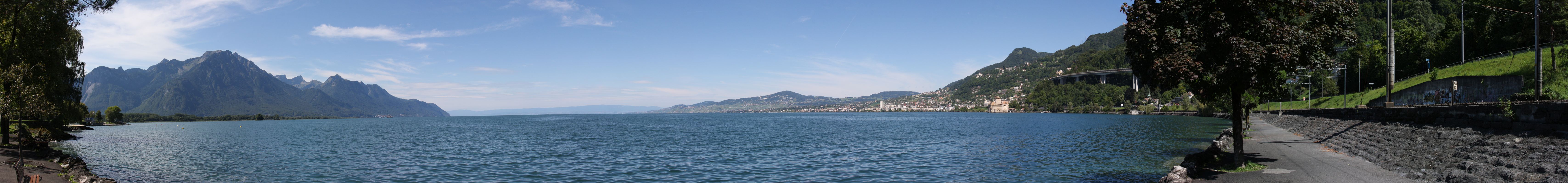
Second one from the shore at Clarens (the western suburb of Montreux) – Montreux on the left, the Rhône mouth in the center; 2056×320 pixels:
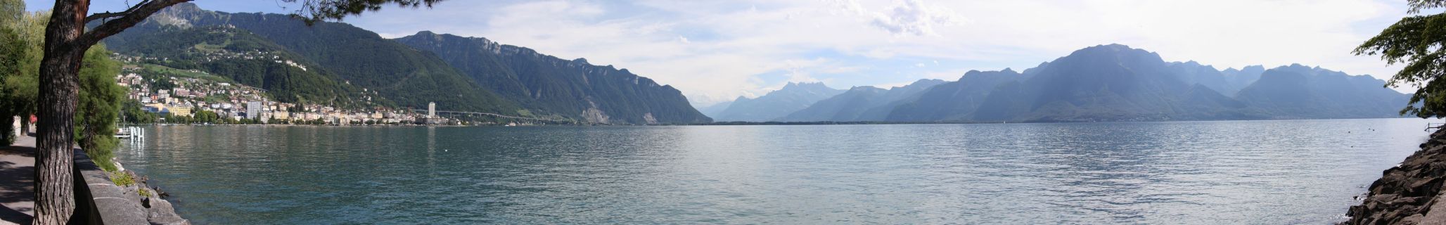
» Single view
» Version with 5140×800 pixels
Number three, unfortunately with the largest vertical differences, so only a rather narrow stripe1: From Glion station, 300m above the lake – you can see Villeneuve and the Rhône mouth well, and the castle of Chillon on the left edge of the lake just made the photo, too; 3332×320 pixels:

» Single view
» Version with 8330×800 pixels
- which can’t really be noticed here, downscaled to 320 and 800 lines ↺
Funiculì, Funiculà
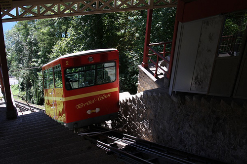
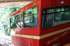
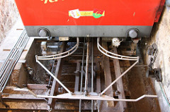
From nature to technology – to the funicular Territet–Glion (about 300m above the lake). (The Italian title is from the song about the opening of such a train on Mount Vesuvius, see Wikipedia.)
One of the cars and a look at the mechanism:
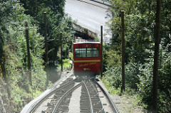
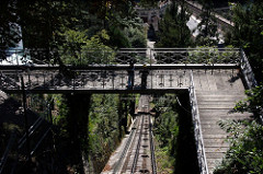
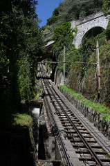
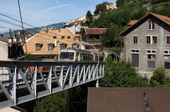
On the ride down a look through the window (in which my bright t-shirt is reflected) shortly before passing the other car going up; and a bridge along the way (photographed through the opening of a small horizontally pivoted window at the top):
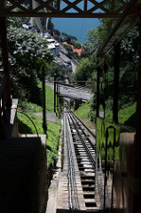
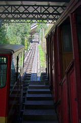
One view from the very top and two from the very bottom:
An old car still to be seen in the lower station (already partly visible on the previous photo):

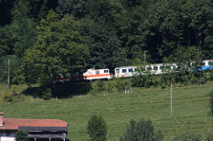
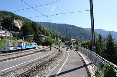
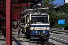
And speaking of railroad vehicles, let’s turn quickly to the Glion station of the cog railroad from Montreux to the Rochers de Naye (the Mountain behind Montreux), right next to the funicular station:
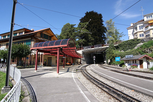
And further below where it passes a bridge at the top edge of Montreux:

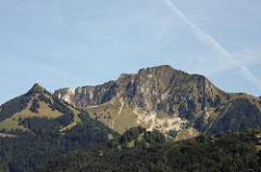
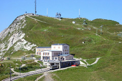
Speaking of the Rochers de Naye: One current photo from lakeside and one from four years ago when I was up there:
Gorge-ous
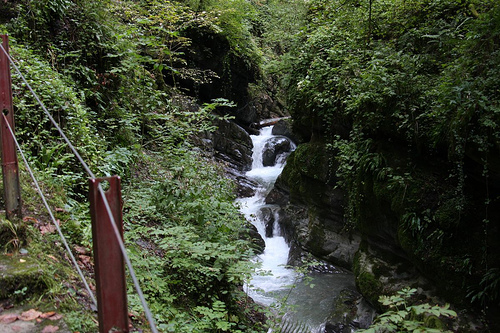
After the castle, let’s head back to nature: into the Gorge du Chauderon, the gorge behind Montreux through which the torrent called Baye de Montreux runs – more specifically into its lower, steeper part.
Here, too, all photos are also available in the Flickr set (without comments, though).
A look back to the beginning – or rather the end, the bottom part where the torrent passes the stilts of that ugly highway, but I was walking up; and we have a look at the rock face:


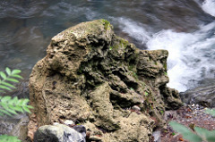
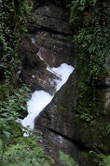
A detail of the torrent – on the left with 1/400 second exposure time, on the right 1/25 second:


Rocks on the ground:

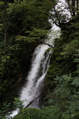
The largest waterfall in the gorge, due to its little bend and the many trees (Cut them down!! The tourists want to see the waterfall!!!) it can hardly be seen completely from one spot – so first the upper part that seems to spring from the trees, then the lower part, again with 1/400 and 1/25 second exposure:
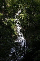

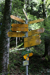
Two other parts of the gorge – and all roads lead to… somewhere.

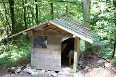
One of the refuges (and barbecue sheds) in the area, with the comforting realization that Uri Geller wasn’t around recently:

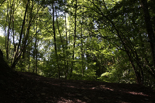
I didn’t go through the entire gorge to Les Avants this time (I went down from there two years ago), but turned right towards Glion where you soon leave the forest and encounter the first houses. (And a funicular railway that I’ll show on one of the next days.)
At the end we have a look at the opposite mountain where also the Montreux-Oberland Bernois railway is passing to Les Avants and on via Gstaad to Lenk.